What is the river doing now?
River levels over 2.3m just below Wray are major floods. These usually are associated with
trees being washed into the river from erosion and landslides
Hindburn levels by Mealbank bridge, Wray. (direct info).
Current height and hydro-graph for the last 7 days.
River levels over 2.3m just below Wray are major floods. These usually are associated with
trees being washed into the river from erosion and landslides
Hindburn levels by Mealbank bridge, Wray. (direct info).
Current height and hydro-graph for the last 7 days.
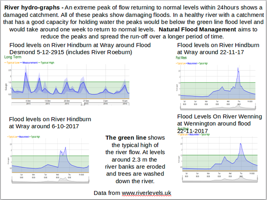
This data can be useful for comparing the weather with the hydro-graph from the river levels measured on the Hindburn at Wray.
The Environment Agency have produced a useful map of surface water flooding. This has picked up nearly all the extreme flood water flows. Connect to site using your postcode
Find out if your property is considered at risk of flooding - Environment Agency.
Find out if your property is considered at risk of flooding - Environment Agency.
|
|
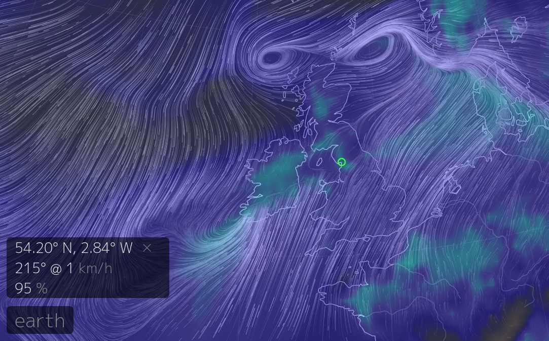
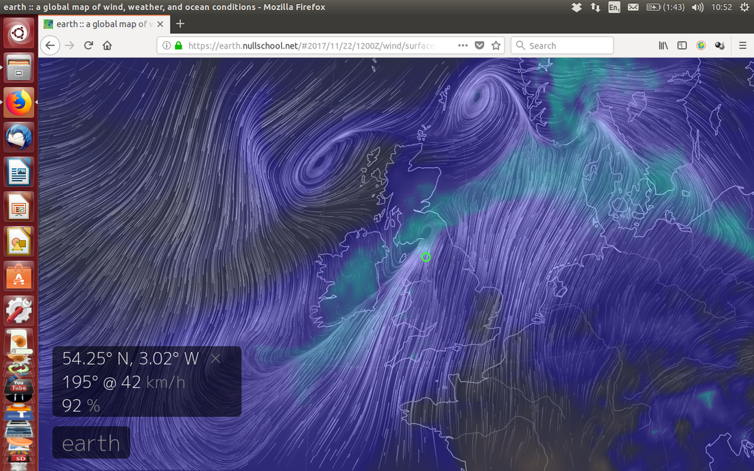
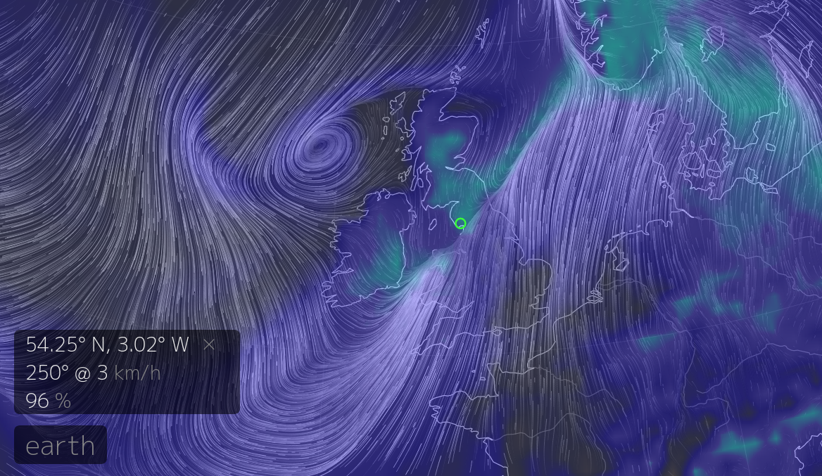
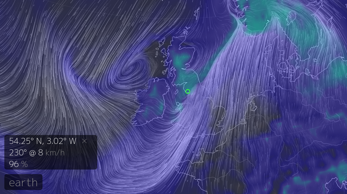
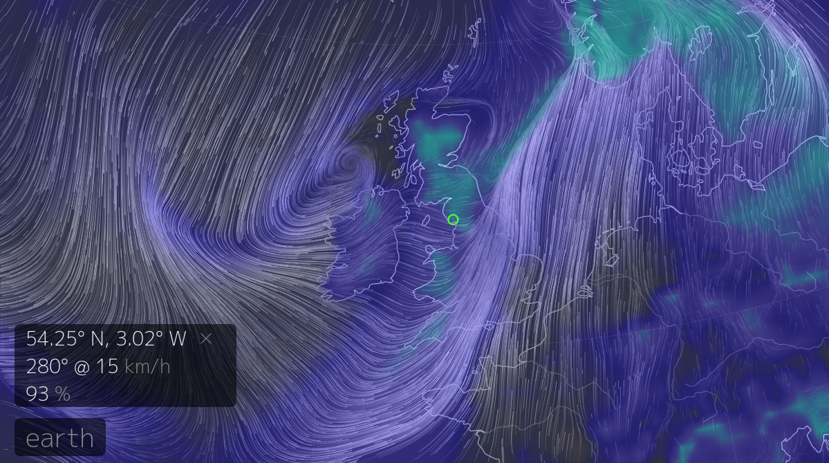
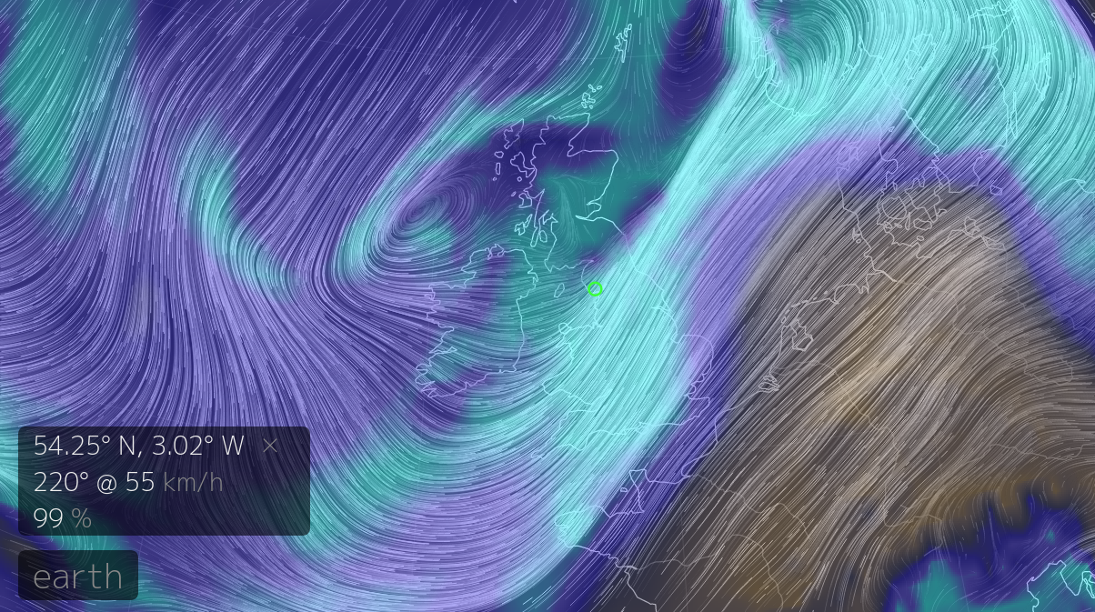
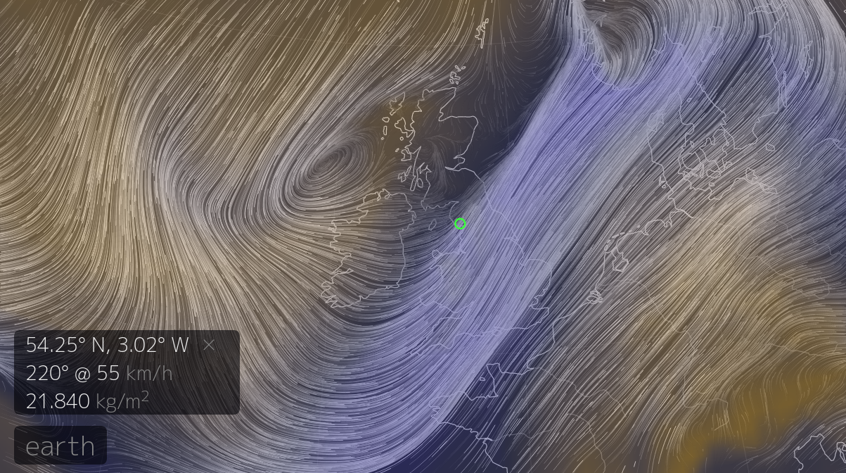
If a storm is approaching you can watch the wind flows, humidity and other data for the current time, and you can scroll back and forwards in time.
Here at .earth.nullschool.net Click on "Earth" to show more data. The images to the left are of the Storm on 22-11-2017 of wind and relative humidity at surface level at 6am, mid day, 18pm, 21pm, 23pm and wind and relative humidity @850hpa at 21pm and wind and total precipitable water @850hpa at 21pm (from earth.nullschool) Historical Rainfall If you would like to look at the rainfall on a particular day look at the Centre for Ecology and Hydrology website and click on a specific location and date.(Currently up to Dec 2015) |